

Cnicht is a mountain in Snowdonia which forms part of the Moelwynion mountain range. Its appearance when viewed from the south-west, i.e. from the direction of Porthmadog, has earned it the sobriquet the “Matterhorn of Wales”.
At 689m, this little peak is dwarfed somewhat by its neighbours to the north but for me it has something of an iconic status and is a great introduction to scrambling for a great many people. I had only tried to climb it once before, but at that time I was not at my most confident and was put off at the foot of the scramble section. Today would be different.
I started my walk from the village of Croesor where there is a car park, toilet and a cafe. Alongside the car park the small brook (Afon Croesor) was babbling away, giving a sense of playful tranquility as I donned my boots.
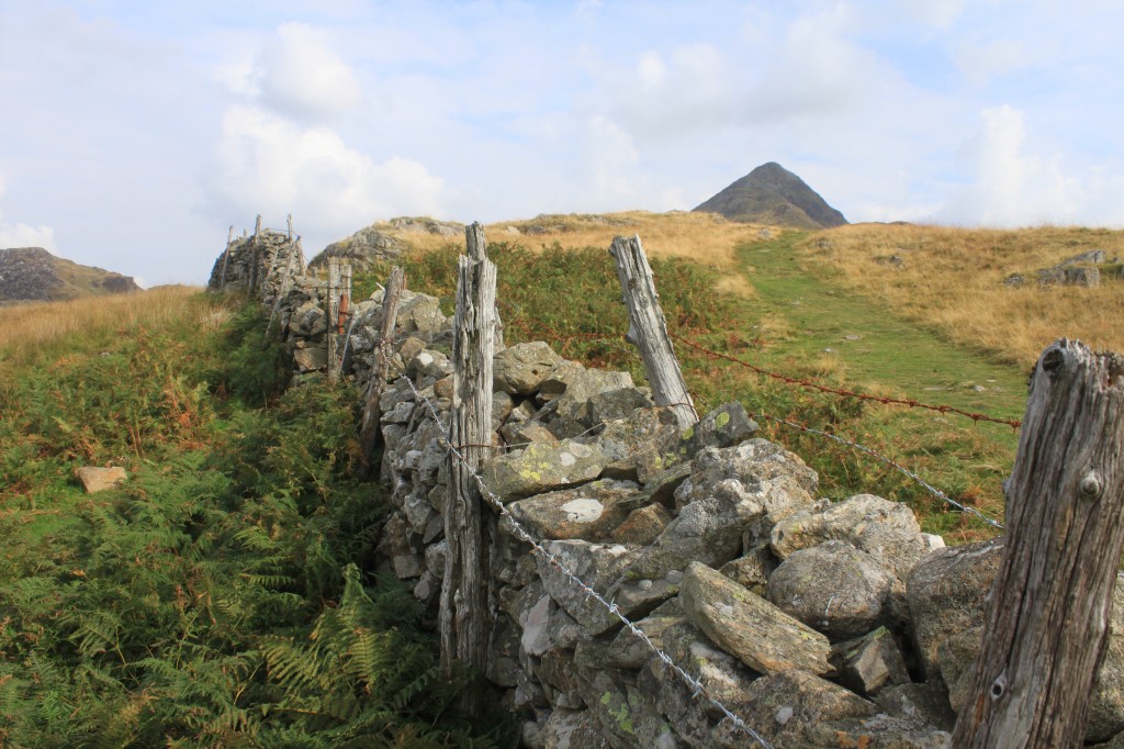
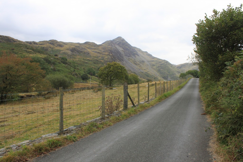
Starting out I began the climb up the track out of the village before veering right through a conveniently waymarked gate and onto the open hillside. The terrain is littered with rocky outcrops and hints of a fascinating past – a disused level here, a hut circle there, and criss-crossed with the odd drystone wall.
Cnicht starts to show itself
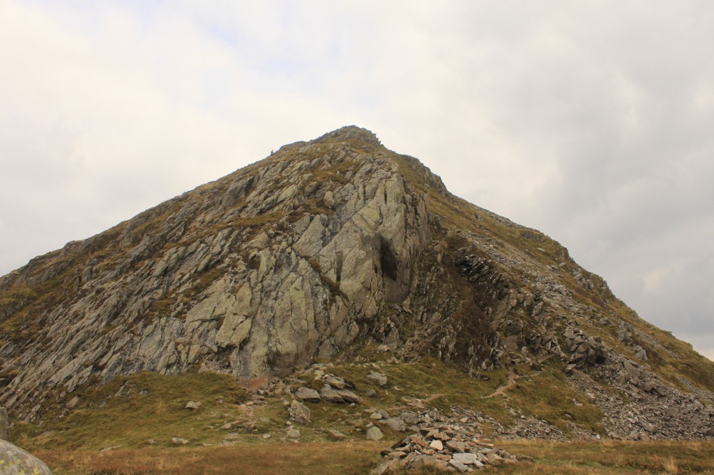
The path remains a fairly clear and easy to follow one as it meanders and climbs round and over rocky outcrops, and as you near the face of Cnicht looms ever larger. Sometimes it seems there must be an easy route to the summit, sometimes it projects a more intimidating sight. Eventually arriving at the foot of the scramble and this is the image before you:
A good spot for a snack
My route would follow the rocky path to the right of the crags and then follow the ridge line to the summit. Not for the first time during this project I was experiencing a healthy level of intimidation, and also not for the first time I drew on the great pleasure of climbing the Baranco Wall on Kilimanjaro. On reaching the summit of Cnicht I just wished the climb had lasted a whole lot longer.

Looking down to Tremadoc Bay
I was delighted. This was a peak I had wanted to climb since I was a student 20 years ago, but had always fallen victim to the draw of Snowdon or the Glyderau, so to finally get here felt fantastic!
Continuing on along the summit ridge I then dropped onto a broad grassy bank and descended to one of this areas numerous small lakes, this one being Llyn yr Adar. The combination of the gathering clouds and the remoteness of this small piece of water gave off an atmospheric image.
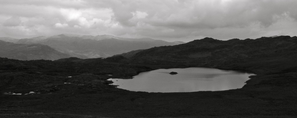
Llyn yr Adar
From here my walk turned right and continued to gradually descend, crossing the occasional boggy section and a small boulder field here and there, to visit an eery example of Snowdonia’s industrial history, Croesor Quarry. You can see from the size of the spoil and the scale of the buildings how large a concern this once was.
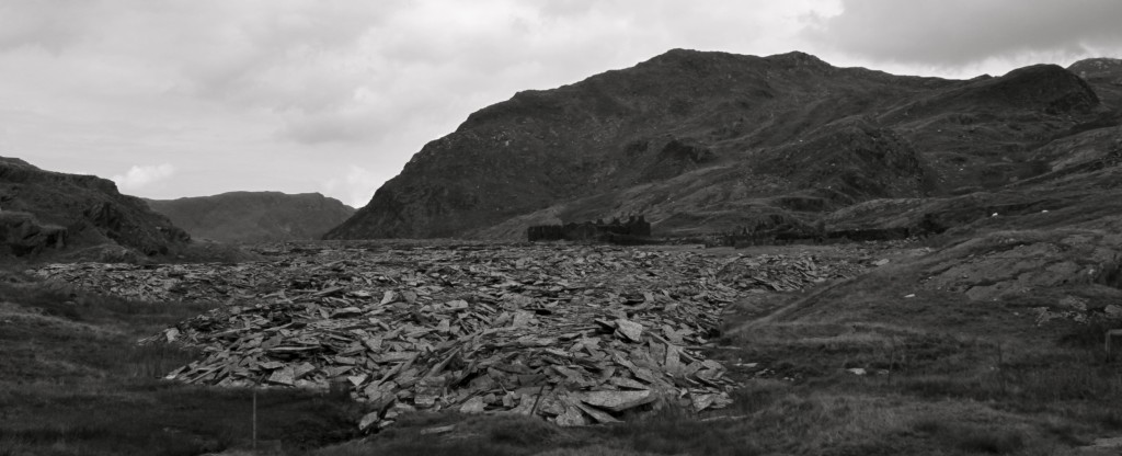
Croesor Quarry
Leaving the quarry behind the return to the village is very straightforward, descending by a gently contoured path straight back down the valley, eventually meeting the valley floor by Moelwyn Bank and Croesor Fawr.
Cwm Croesor
This walk and route was a perfect fit for my 14 in 2014 challenge, taking me to a peak I’d long wanted to climb, and it rewarded me with a fantastic day to blow the cobwebs off and give me a real lift.
Please remember that this challenge is not just about me having good fun on mountains I hadn’t climbed before, it’s also about the incredible volunteers who keep us safe and put their own lives on the line to help people in trouble in the mountains. Those magnificent Mountain Rescue teams up and down the country who can only continue to save peoples lives through donations from the public. So please consider a donation.
-

- Cnicht starts to show itself
-

- A good spot for a snack

-

- Looking down to Tremadoc Bay
-

- 6. Cnicht
-

- Llyn yr Adar


-

- Croesor Quarry
-

- Cwm Croesor